Graphic by: Yiqi Shao
A cloud is a visible aggregate of tiny water droplets and/or ice crystals suspended in the atmosphere and can exist in a variety of shapes and sizes. Some clouds are accompanied by precipitation; rain, snow, hail, sleet, even freezing rain. The purpose of this module is to introduce a number of cloud classifications, different types of precipitation, and the mechanisms responsible for producing them. The Clouds and Precipitation module has been organized into the following sections:
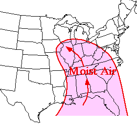
| Sections | Development Water is known to exist in three different states; as a solid, liquid or gas. 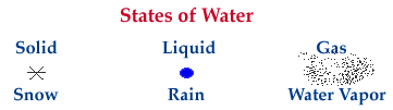 Clouds, snow, and rain are all made of up of some form of water. A cloud is comprised of tiny water droplets and/or ice crystals, a snowflake is an aggregate of many ice crystals, and rain is just liquid water. 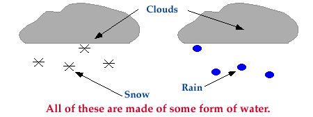 Water existing as a gas is called water vapor. When referring to the amount of moisture in the air, we are actually referring to the amount of water vapor. If the air is described as "moist", that means the air contains large amounts of water vapor. Common sources of moisture for the United States are the warm moist air masses that flow northward from the Gulf of Mexico and western Atlantic Ocean as well as the moist Pacific air masses brought onshore by the westerlies.
Cloud Types High, middle and low-level clouds, vertically developed clouds, plus some less common cloud types. Clouds are classified into a system that uses Latin words to describe the appearance of clouds as seen by an observer on the ground. The table below summarizes the four principal components of this classification system (Ahrens, 1994).
Further classification identifies clouds by height of cloud base. For example, cloud names containing the prefix "cirr-", as in cirrus clouds, are located at high levels while cloud names with the prefix "alto-", as in altostratus, are found at middle levels. This module introduces several cloud groups. The first three groups are identified based upon their height above the ground. The fourth group consists of vertically developed clouds, while the final group consists of a collection of miscellaneous cloud types.
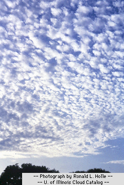
Low-level Clouds 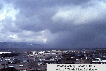 Photograph by: Holle Vertically Developed Clouds 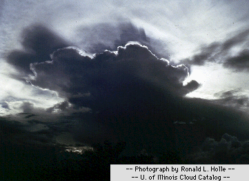 Photograph by: Holle Other Cloud Types
Precipitation
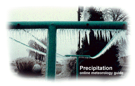 Photograph by: Norene McGhiey When cloud particles become too heavy to remain suspended in the air, they fall to the earth as precipitation. Precipitation occurs in a variety of forms; hail, rain, freezing rain, sleet or snow. This portion of the Clouds and Precipitation module focuses on precipitation and has been organized into the following sections.
The navigation menu (left) for this section is called "Precipitation" and the menu items are arranged in a recommended sequence, beginning with this introduction. In addition, this entire web server is accessible in both "graphics" and "text"-based modes, a feature controlled from the blue "User Interface" menu (located beneath the black navigation menus). More information about the user interface options, the navigation system, or WW2010 in general is accessible from About This Server. Acknowledgments
John Walsh - Content Reviewer - Professor of Atmospheric Sciences who edited module text and diagrams for scientific accuracy. Ken Beard - Content Reviewer - Professor of Atmospheric Sciences who edited module text and diagrams for scientific accuracy. Mythili Sridhar - Graphics Assistant- Graphically enhanced previous version of this module. Yiqi Shao - HTML Programmer and Graphics Assistant - Helped with the integration of this module into the WW2010 format and constructed home page graphic. |
The navigation menu (left) for this module is called "Clouds, Precipitation" and the menu items are arranged in a recommended sequence, beginning with this introduction. In addition, this entire web server is accessible in both "graphics" and "text"-based modes, a feature controlled from the blue "User Interface" menu (located beneath the black navigation menus). More information about the user interface options, the navigation system, or WW2010 in general is accessible from About This Server.
Aucun commentaire:
Enregistrer un commentaire